UAV Data Collection

Union Pacific Railroad (UPRR) – Bullfrog Junction Mapping

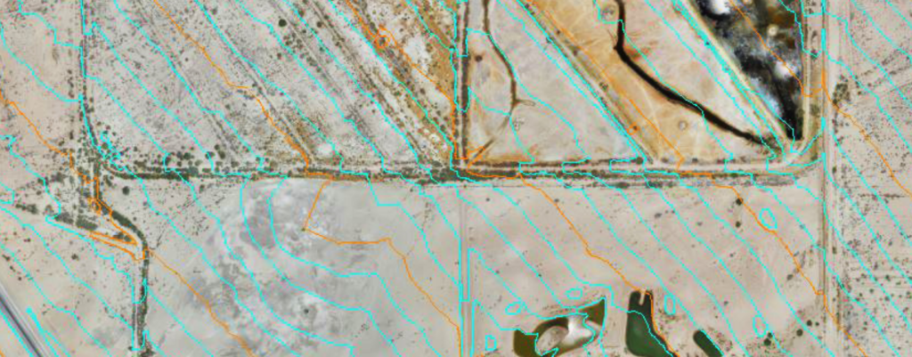
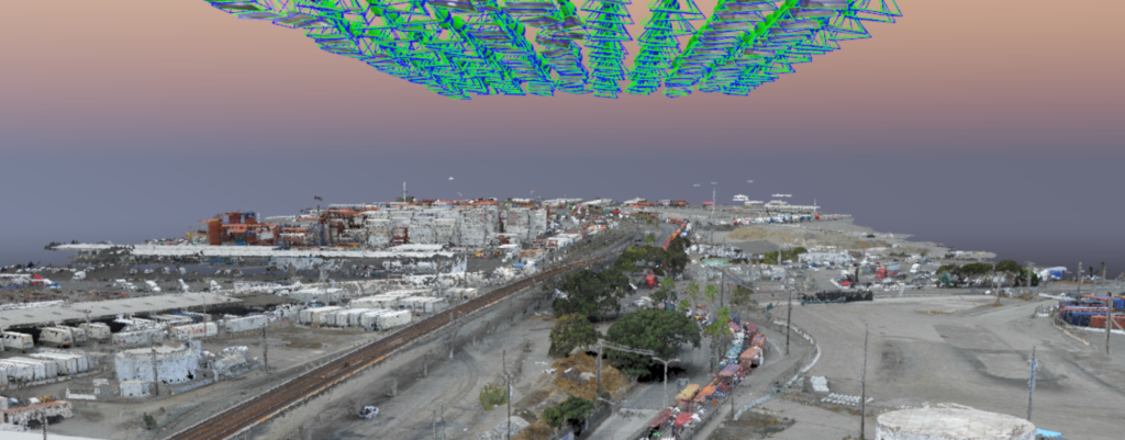
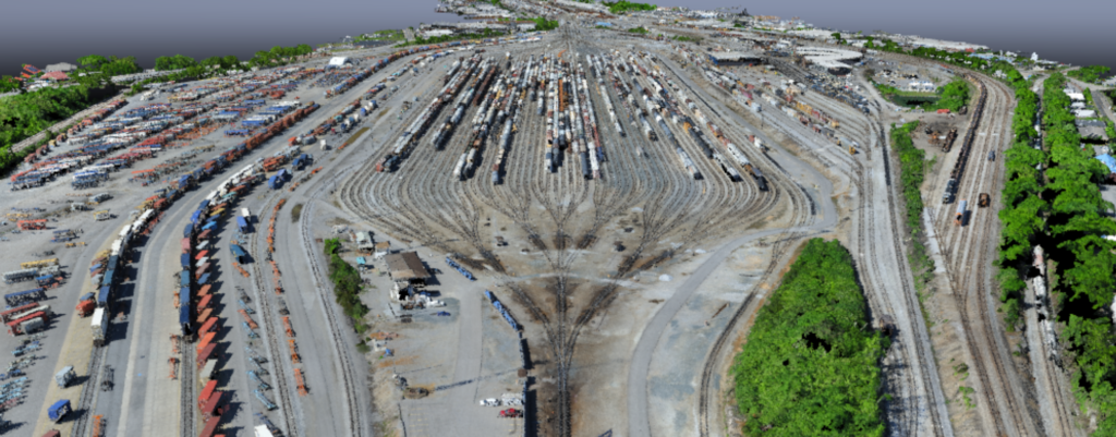
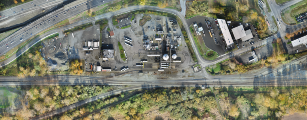
Zephyr UAS, Inc. (ZUI) conducted an aerial mapping survey and managed the performance of supplemental ground survey for this critical project for Union Pacific Railroad (UPRR). The North Loop Project proposed the addition of approximately 5,000 feet of new trackwork infrastructure to support UPRR facility operations at Bullfrog Junction in the Tacoma, WA area. However, …

Union Pacific Railroad (UPRR) – Bullfrog Junction Mapping Read More »

Southern California Regional Rail Authority (SCRRA)/Metrolink – Coastal Mapping

Zephyr UAS, Inc. (ZUI) provided collection services for 5 miles of ortho-rectified photogrammetry and mapping of Metrolink’s coastal corridor in San Clemente, CA. This portion of the commuter rail system is next to the Pacific Ocean. With the upcoming “El Nino” conditions, Metrolink utilized the mapping to assess and protect the railroad infrastructure from the …

Southern California Regional Rail Authority (SCRRA)/Metrolink – Coastal Mapping Read More »

Los Angeles County Sanitation District (LACSD) – Effluent Tunnel Outfall Construction Project

In 2012, the Los Angeles County Sanitation District’s Board of Directors approved the Clearwater Project to protect local waterways by addressing aging critical infrastructure. Under this project, a new 7-mile tunnel will be built from the Joint Water Pollution Control Plant (JWPCP) located in Carson CA to the existing ocean outfalls located at Royal Palms …

Los Angeles County Sanitation District (LACSD) – Effluent Tunnel Outfall Construction Project Read More »

California High-Speed Rail (CHSR) Authority – Burbank to Los Angeles & Los Angeles to Anaheim Segments

Zephyr UAS, Inc. (ZUI) provided collection services for 42 miles of ortho-rectified photogrammetry and mapping in support of the environmental and preliminary engineering analysis of the high-speed rail program in Southern California. This urban corridor is the most challenging of the 500-mile system planned by the State Authority, where it will co-exist with commuter rail …

California High-Speed Rail (CHSR) Authority – Burbank to Los Angeles & Los Angeles to Anaheim Segments Read More »

BNSF Railway (BNSF) – Commerce Intermodal Facility Expansion

Zephyr UAS, Inc. (ZUI) provided aerial photography and aerial mapping services to BNSF Railway for the upcoming yard expansion of its Intermodal Facility in Commerce, California. The Commerce Intermodal Facility is the newest Intermodal Hub in the Pacific Southwest Region. With on-going operations within its support and working track areas, collecting data without service interruptions …

BNSF Railway (BNSF) – Commerce Intermodal Facility Expansion Read More »

Terwilliger Plaza – As-Built Survey

Zephyr UAS Inc. (ZUI) was contracted by Terwilliger Plaza to perform an as-built survey of a major slope stabilization project in the southwest Portland area. The geotechnical improvements were installed to strengthen a steep slope which currently retains a public two-lane highway, residential housing, significant amounts of vegetation, and overhead power lines. The slope was …

Terwilliger Plaza – As-Built Survey Read More »

Alameda County Transportation Commission – 7th Street Grade Separation

The Alameda County Transportation Commission (ACTC) is looking to increase capacity and improve the flow of goods along 7th and Matitime Streets in and out of the Port of Oakland’s facilities.  The proposed 7th Street Grade Separation Project will provide maximum operational flexibility for both vehicular and rail traffic.  Zephyr UAS, Inc. (ZUI) provided collection services …

Alameda County Transportation Commission – 7th Street Grade Separation Read More »