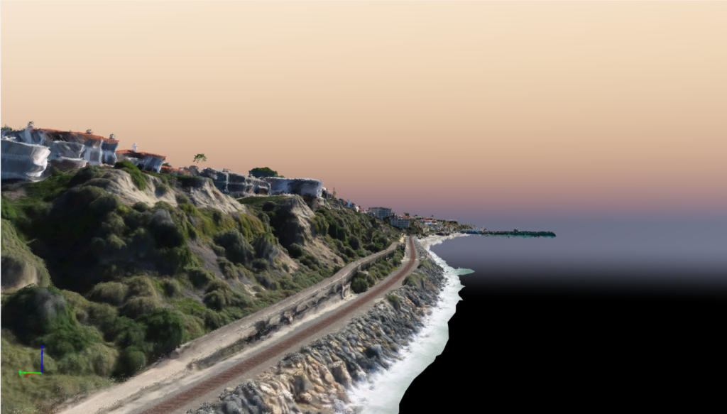
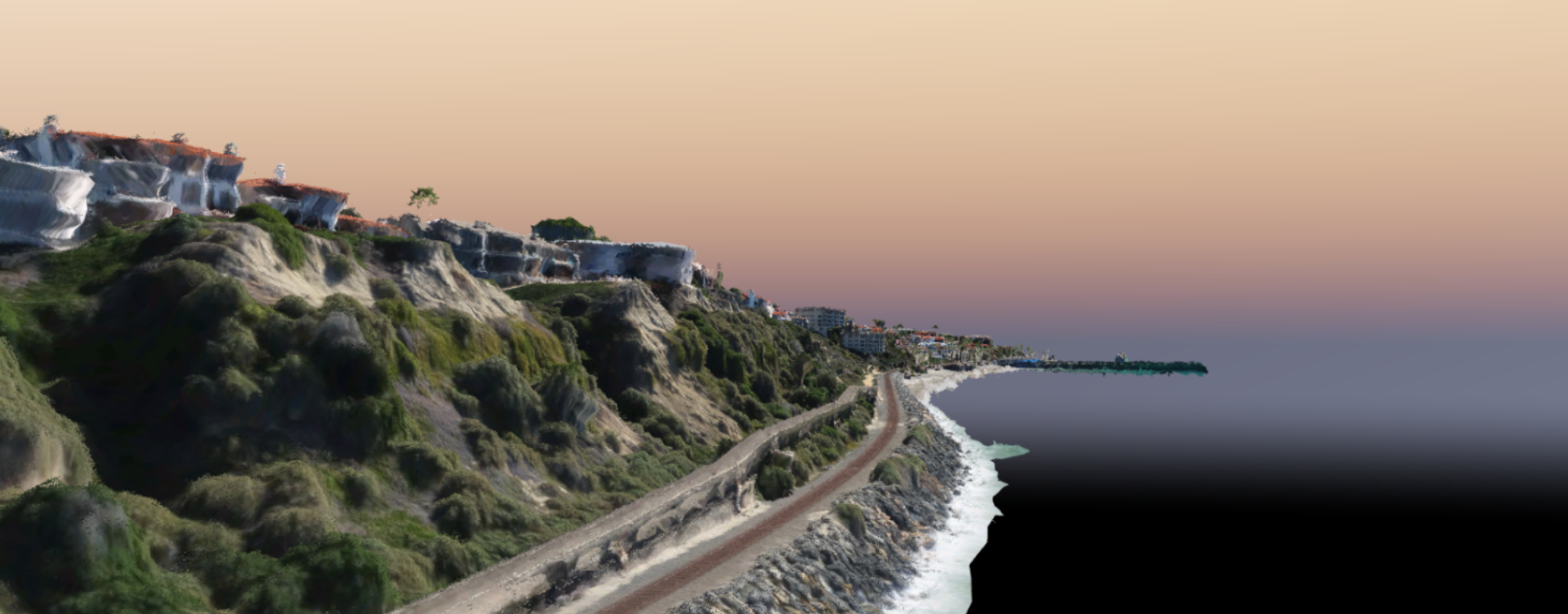
Zephyr UAS, Inc. (ZUI) provided collection services for 5 miles of ortho-rectified photogrammetry and mapping of Metrolink’s coastal corridor in San Clemente, CA. This portion of the commuter rail system is next to the Pacific Ocean. With the upcoming “El Nino” conditions, Metrolink utilized the mapping to assess and protect the railroad infrastructure from the coastal influence of the upcoming storms.